


Stop Water from Flooding Your Budget: A hydrologist’s guide to cost-effective flood risk management


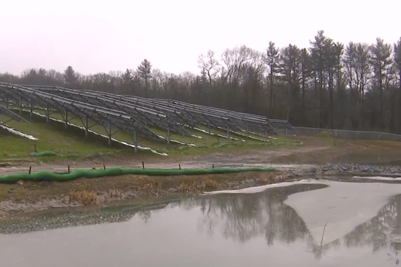
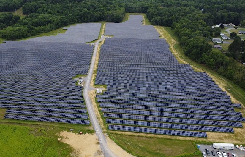
A decade ago, most utility-scale solar projects were built on flat, well-drained land. Today, those sites are largely gone. What remains are parcels that sit lower, drain poorly, or come with a history of standing water.
At the same time, storms are becoming more frequent and more intense. What used to be considered a “100-year storm” is now showing up far more often in many regions. Over a 30- to 35-year project life, that event carries roughly a one-in-three chance of occurring.
 Yet, flood risk is still treated as something confined to the project boundary.
Flood risk is a watershed issue — not confined to a single site. The risk doesn’t begin at the property boundary; it’s driven by watershed processes and should be evaluated accordingly, rather than as a site-specific issue. Many early-stage assessments focus only on the site footprint. In reality, the entire watershed determines how water reaches and impacts a project. And that watershed is always changing.
A new upstream subdivision, roadway, or land use shift — from forest to agriculture or pavement — can significantly increase runoff and accelerate how quickly it reaches your site. Downstream, projects often rely on drainage infrastructure that may be decades old and no longer performing as designed. Outdated floodplain maps add to the problem. In some areas, the most recent mapping dates back more than a decade; in others, several decades. These maps can create a false sense of security, but outdated maps don’t reduce risk — they hide it.
Updated modeling often tells a different story. On multiple projects, using current land use data instead of legacy floodplain designations has resulted in materially different base flood elevations. In some cases, this has triggered necessary design changes, such as racking adjustments or additional storage, that would have otherwise been missed.
Authorities Having Jurisdiction (AHJs) are increasingly aware of this gap. Even sites outside mapped flood zones are now being asked to provide full hydraulic modeling, with submitted results sometimes informing future floodplain updates.
What accurate flood assessment requires
What does a more accurate flood assessment require?
At a minimum, it means working with current, site-specific data, often beyond what’s included in early-stage studies:
- Updated land use across the full contributing watershed
- High-resolution LiDAR terrain data
- A detailed map of drainage infrastructure, including culverts, road crossings, channels, and spillways
Infrastructure deserves particular attention. Across the U.S., drainage systems are aging. Culverts clog, sediment builds up, and capacity declines over time. A structure operating at half its design capacity can create backwater effects that standard desktop analyses won’t catch. Field verification is often simple, but critical. In many cases, a quick inspection can reveal conditions that significantly affect flood behavior.
Running a full hydrologic and hydraulic model with these inputs typically takes one to two weeks. Discovering a flood issue during permitting can cost months; the cheapest fix is the one you design before the layout is finalized.
Design around water, not against it
Early modeling doesn’t just identify risk; it creates better design options. On a recent project, updated modeling revealed an unexpected issue: a downstream culvert had created a backwater effect, pushing water nearly three feet into parts of the array during a design storm. The initial solution was to raise the entire racking system — straightforward, but expensive.
A closer look told a different story. By analyzing how runoff moved across the site, the team identified an alternative: a graded swale along the upslope edge of the array. This redirected flow around the panels before it could accumulate. The result avoided structural changes, reduced cost, and improved performance.
The principle is simple: don’t fight the water — redirect it.
Vegetation can play a role as well. Deep-rooted pollinator plantings (increasingly used under solar arrays) improve soil structure and increase infiltration. Even on less permeable soils, these plantings can improve infiltration by 10–15 percent, reducing peak runoff over time.
In colder climates, seasonal conditions introduce another layer of risk. Detention ponds (often a default requirement) can freeze beneath panel arrays after storm events, limiting safe access for maintenance. In these cases, routing drainage to the site perimeter instead of retaining it onsite can eliminate an operational challenge.
The cost of waiting
The business case for early hydrologic analysis is straightforward. On large projects with tens of thousands of piles, conservative assumptions — such as raising racking heights beyond what is necessary — can add hundreds of thousands of dollars in material costs alone. The analysis needed to avoid that cost is relatively small.
Schedule impacts are even more significant. A comprehensive assessment may add one to two weeks early in design. A flood-related permitting issue can delay a project by months, often with direct financial consequences. For developers and investors, that translates into real risk.
Flood risk doesn’t start at the fence line. The cost of ignoring that reality only shows up later. Your goal shouldn’t be to over-engineer. If you design with clarity and certainty, your site can operate reliably throughout its lifetime.
 Hossein Ghoveisi, PhD, EIT, is Hydrology Lead at Castillo Engineering, a utility-scale design and engineering firm specializing in full-service solar, energy storage, and high-voltage solutions. With 15+ years of experience in engineering water resource projects, Hossein works with grading and drainage designers to align watershed analysis, site grading, and drainage for solar projects.
Castillo Engineering | www.castillope.com
Author: Hossein Ghoveisi
Volume: 2026 May/June