


At Your Own Risk: Evaluate terrain to avoid costly project failures


For decades, the renewable energy industry has treated topography as a secondary concern. Developers routinely lock in land agreements and secure interconnection queue positions based on flat maps and surface-level data. The common mindset is simple: terrain is just an obstacle that engineers can work around later.
This assumption is creating massive financial exposure for modern solar and wind projects. By the time topography becomes a documented problem, teams have likely already spent substantial time and capital.
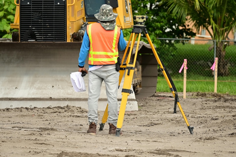
The most expensive terrain challenges are the ones discovered after site selection. Resilient, efficient project pipelines depend on developers’ careful evaluation of terrain as a first-pass feasibility check at the earliest stage. Using integrated GIS data upfront allows teams to analyze topography alongside environmental data, utility infrastructure, and property lines. Viewing these elements together reveals a parcel’s true usable footprint and rules out non-viable sites quickly. Instead of wasting resources studying unsuitable options, teams can prioritize high-potential land and build more accurate financial assumptions from the start.
Feasibility constraint vs design variable
Topography’s impact is often misunderstood when reduced to slope adjustments and grading. In reality, terrain determines usable acreage, layout efficiency, and overall project economics to define what is truly possible on a site.
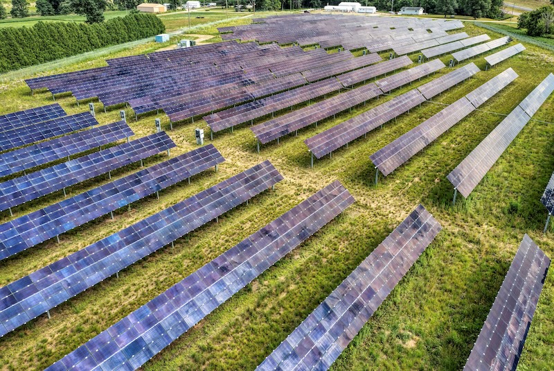
Steep slopes can significantly reduce the actual buildable area of a parcel, while elevation changes drive up grading costs — which can vary widely based on terrain, ranging from as little as $50,000 to more than $2.5 million on large-scale projects. But those considerations only scratch the surface; other terrain irregularities can lead to inefficient panel or turbine placements, and costs can continue to surface long after construction is complete. Hilly topography and unaddressed near-shading, for example, can reduce annual energy production by 5 to 10 percent.
These complications are becoming more common as land scarcity pushes developers toward sites that may be less suitable. The most accessible, flat, and easy-to-develop land has already been claimed. Project teams are looking at challenging topography that increases construction costs even before additional setbacks arise. When parcels aren’t assessed early, terrain issues can hide out of sight and delay the discovery of unbuildable zones.
Every acre lost to terrain will cost you
In addition to triggering a cascade of expensive problems, discovering complex topography during the later phases of due diligence forces teams into reactive mode. The most immediate result is typically a project redesign. When engineers resort to shrinking a project’s footprint to avoid unbuildable areas, acreage is lost and energy yields dip. This sets off a chain reaction of delays in permitting and local approvals, as updated site plans undergo further scrutiny.
This can compromise the project’s foundation. Financial models must be completely overhauled to account for increased civil costs and decreased power generation. Interconnection complications arise if the newly reduced system size no longer matches the approved application. Eventually, these unexpected shifts erode investor confidence and threaten financing.
Understand how site constraints interact
Evaluating topography alone only tells part of the story. Terrain interacts with parcel boundaries, environmental constraints, and transmission access, and these overlapping factors determine a site’s viability.
A parcel that looks perfect on paper can quickly fall apart when different data layers are considered together. Access route limitations may surface, buildable areas can shrink due to setbacks, and infrastructure placement often becomes impractical once real-world conditions are accounted for. To avoid these risks, developers need a new approach that puts terrain evaluation ahead of due diligence processes — and well before land acquisition.
Positioning terrain analysis as the foundation of intelligent decision-making, rather than a standalone risk mitigation tool, gives developers a clear advantage as pressure on the clean energy sector intensifies. With tighter margins and rising competition for sites, interconnection queues now demand both speed and precision. Developers can’t afford to isolate topography and treat it as a downstream obstacle. It’s a first-pass filter that is critical to early evaluation, risk elimination, and smarter projects.
As General Manager of Latapult, Christopher Nichols brings more than 30 years of experience in GIS and remote sensing technology. He has channeled his passion for creating simple yet powerful geospatial solutions into a career dedicated to advancing the way organizations use data to make faster, smarter decisions. With the collaborative spirit and dynamic energy of Latapult’s multifaceted team, Chris excels at guiding full-cycle product development from concept to market. A licensed Professional Land Surveyor (PLS) and certified GIS Professional (GISP), Chris’s credentials add depth and credibility to his leadership. He holds a Master of Science in Environmental Studies with a concentration in Geographic Information Systems and Remote Sensing from the Medical University of South Carolina, as well as a Bachelor’s degree in anthropology/geology/earth Science from the University of South Carolina.
Latapult | latapult.com
Author: Christopher Nichols
Volume: 2026 May/June