

New York's Predevelopment Activities Advance Offshore Wind


In July 2019, Governor Cuomo announced the winners of New York's first comprehensive offshore wind solicitation - the Empire Wind and Sunrise Wind projects - totaling nearly 1,700 megawatts. As the single largest renewable energy procurement made by a state in U.S. history, these two projects are expected to produce enough offshore wind energy to power more than one million homes, and support more than 1,600 jobs with a combined economic activity of $3.2 billion statewide. This will help jump start progress towards New York's unprecedented offshore wind goal: 9,000 megawatts by 2035.
 To accomplish this, the New York State Energy Research and Development Authority (NYSERDA) has been leading the coordination of offshore wind opportunities, seeking to advance New York State's goals in a way that is both responsible and cost-effective. As a result of this philosophy, the State is continuing its proactive approach to investing in predevelopment activities.
As part of the New York State Offshore Wind Master Plan[1] released in January 2018, the State invested in bringing together existing data, new research, and feedback from stakeholders to inform the federal Bureau of Ocean Energy Management (BOEM) in the identification of new lease areas in the New York Bight. New lease areas that are in proximity to New York City, the State's "load center," are critical in advancing the State's goals.
As BOEM reviews the draft Wind Energy Areas[2], the State is investing in predevelopment activities to gain a better understanding of the physical and environmental conditions in these areas. This will reduce developer risk, which will enable developers to submit more competitive bid prices into New York's offshore wind solicitations. These activities are expected to provide a starting point for project development, but not to displace the work developers will need to undertake to design, permit, and construct their projects.
Accurate meteorological and oceanographic - metocean - data is essential to understanding project productivity and profitability. It is used to inform optimal site layout, design, and, perhaps most importantly, to understand the wind resource and expected generation from an offshore wind project installed in the area.
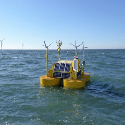 With this in mind, NYSERDA deployed two metocean buoys in August. The buoys are located more than 20 miles off New York's coast (in BOEM's designated Draft Wind Energy Areas) and each buoy will collect data for two years. These (LiDAR) buoy systems are fitted with remote sensing equipment that uses pulsed laser light to determine wind speeds and direction at turbine height, along with wave and current measurements. The two made-to-order buoys were deployed in the North Sea for validation against a meteorological measurement tower - metmast - in accordance with Carbon Trust OWA Stage 2 standard and International Electrotechnical Commission (IEC) standard 61400-12-1 CDV. The buoys represent a $4.5 million investment by New York that is expected to bring a nearly half billion dollar return on investment through lower offshore wind developer bids.
For example, an improvement in data quality sufficient to reduce a developer's uncertainty in modeled base-case wind speed for an 800-megawatt offshore wind project - from an annual average of 9.0 meters per second (m/s) to 9.1 m/s - could result in approximately $130 million in additional energy production (over the 25-year life of the project). If this information was collected by the developer that submitted a bid into a State solicitation, the savings would accrue exclusively to the developer. If this data was available priorto a State's offshore wind solicitation, the savings accrued would be expected to be shared by both the State and developer, via lower developer bids. If we further assume that four 800 megawatt projects could benefit from similar data refinement, then the aggregate benefit would jump to almost $530 million over 25 years.
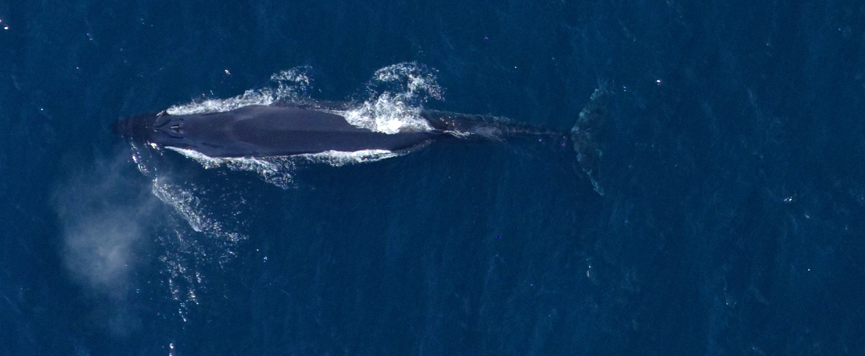
In addition to collecting traditional Metocean data, the buoys will feature other environmental sensors that will collect information about birds, bats, marine mammals, and fish. Above the water, passive acoustic receivers will detect and record bird vocalizations and bat sonar activity. The buoyed platforms will also host the first long-term deployment of radio antennas this far off the coast, for detecting the passage of tagged birds. With support from BOEM, U.S. Fish and Wildlife has tagged hundreds of red knots, terns, and other threatened and endangered bird species with radio transmitters. As the birds pass radio receivers, the nanotag signals will be recognized and recorded. Under the water, passive acoustic hydrophones on each buoy will detect marine mammal presence, while passive acoustic receivers will detect tagged fish for SUNY Stony Brook.
Similar to predevelopment benefits from metocean buoys, early stage investment in wildlife surveys is important due to interannual variability of wildlife migrations. Advancing this work early in the development process accelerates the development timeline, while also protecting wildlife. In the summer of 2017, NYSERDA began to conduct a 3-year, 4-season planning level wildlife survey of the NY Bight using digital images from aircraft. The images are collected at a flight elevation of 1,360 feet, and then analyzed by taxonomists to identify all imaged wildlife, many to the species level. The project collected more than 3.5 million images, providing broad scale contemporary data about the seasonal, interannual, and spatial distributions of wildlife in the NY Bight, as well as supporting BOEM in the identification of new, responsibly-sited lease areas.
Metocean data will be made publicly available when data collection begins. Wildlife data is publicly available via a remote data server.
In addition to these activities, New York State is now advancing an approach to invest in planning level geophysical and geotechnical surveys of BOEM's new Wind Energy Areas. These surveys will provide developers the data they need, when they need it, to maximize its value and help advance the State's progressive goals efficiently, cost-effectively, and responsibly.
Kate McClellan Press is the Project Manager and Gregory Lampman is Program Manager of the Environmental Research Program at New York State Energy and Research Development Authority, which promotes energy efficiency and the use of renewable energy sources. Collectively, NYSERDA's efforts aim to reduce greenhouse gas emissions, accelerate economic growth, and reduce customer energy bills. Governed by a 13-member Board, NYSERDA has provided objective information and analysis, technical expertise, and support in New York State since 1975. LiDAR buoy systems developed by EOLOS, supplied by Ocean Tech Services, with data management and validation by DNV GL. This Metocean data will be made publicly available via their data server, Resource Panorama. High Resolution Digital Aerial Survey data collected by Normandeau Associates with APEM Inc. Public access to wildlife data courtesy of Normandeau Associates.
NYSERDA | www.nyserda.ny.gov
[1]https://www.nyserda.ny.gov/All-Programs/Programs/Offshore-Wind/Offshore-Wind-in-New-York-State-Overview/NYS-Offshore-Wind-Master-Plan
[2]https://www.boem.gov/NY-Bight/
Author: Kate McClellan Press and Gregory Lampman
Volume: 2019 September/October