

Leveraging Aerial Imagery for Solar


Over the past few years, the use of technology in the solar installation workflow has absolutely exploded. Yet there's one question I continue to hear time and again, one that stumps the most brilliant minds in the industry.
"What's the difference between the types of aerial imagery I can use?"
It's a good question, which can be answered in greater detail below. We'll look at the three most important types of aerial imagery - satellite, fixed-wing aircraft, and drones - and why fixed-wing aerial imagery is considered by many to be the most effective and accurate throughout the solar planning process.
Aerial Imagery for Solar Design
Aerial imagery can enable efficient solar design practices in a few different ways. First and foremost, it's a terrific way to either eliminate or complement costly and time-consuming site visits. Designers can simply view the imagery on their device, which provides a comprehensive view of the entire property and structure, without setting foot on the property. Using aerial imaging can achieve extremely accurate results when designing remotely. However, much of this accuracy depends on the type of aerial imagery being used.
The Aerial Imagery Trio
The most commonly known type of aerial imagery, satellite imagery, is captured at an average altitude of 2,600,000 feet (think Google Maps). As it's captured frequently at a very high altitude, satellite imagery has the benefit of both recency and covering a broad geographic range.
At such a high altitude, however, the image quality and resolution are incredibly lacking. Given the poor quality of satellite imagery, the ideal solar use case is for lead and project qualification in the beginning of the process.
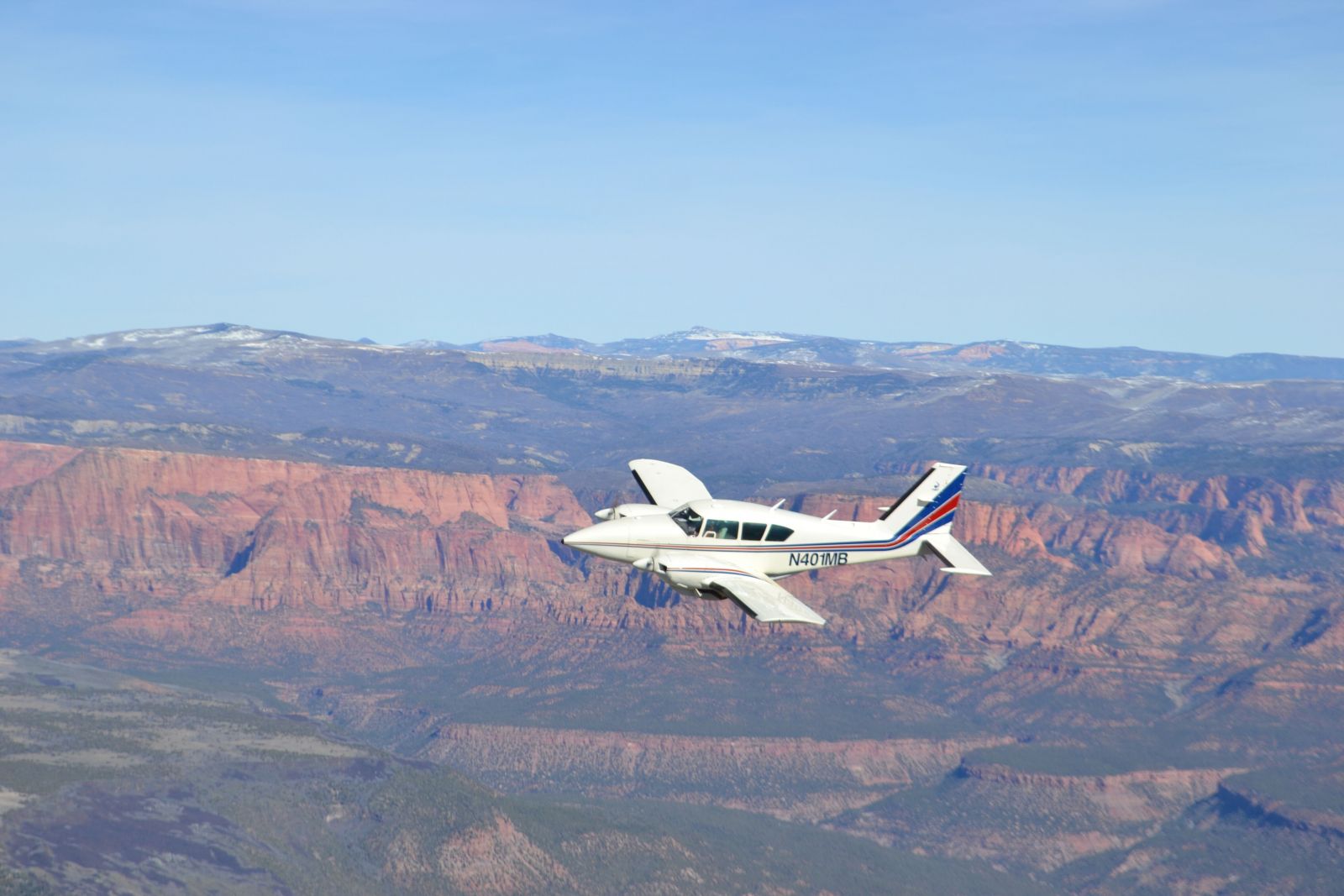
Fixed-wing aerial imagery is captured by airplanes with advanced camera systems at roughly 7,000 feet, providing a sharp image quality and resolution. Although the geographic coverage is limited for low-population rural or remote areas, fixed-wing enables remote solar processes in most of the country. Due to its high resolution and accuracy, this type of imagery is ideal for both lead/project qualification, as well as system design and installation planning.
Drones require an actual on-site visit to capture imagery, which involves a highly manual process that adds additional time to the solar project timeline. Its lower altitude (approximately 100 feet or less) produces high-resolution imagery, and the timeliness of the results makes it ideal for system design and installation planning.
When it comes to solar design, the key differentiators are the ground sample distance (GSD) and perspectives each technology can provide.
Ground Sample Distance - What is it?
Simply put, GSD is the distance between pixel centers measured on the ground, which determines the resolution and accuracy of any extracted or gathered data.
For solar panel roof designs, a GSD of 3 inches or less is ideal to ensure that the design is highly accurate. While satellite imagery has an average GSD of over 12 inches, both fixed-wing and drone imagery can come in at under 3 inches.
Multiple Perspectives
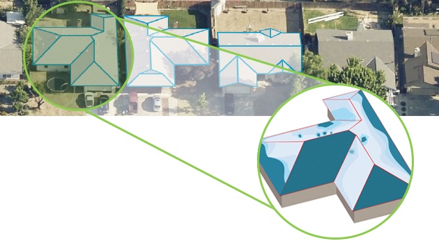
Many of us are used to seeing only one perspective with aerial imagery: the orthogonal, or top-down view, which is effective for determining horizontal features and measurements.
However, a big benefit for solar design is oblique imagery. Oblique imagery is taken at an angle to show a 3D view of properties and structures, allowing users to determine both horizontal AND vertical features and measurements. Fixed-wing aircraft and drones can capture oblique imagery accurately, but satellites fly at such a high altitude that the obliques they capture have poor image quality and resolutions that are not practical for use.
Tracing on Imagery vs. Extracted Data from Imagery
The simplified method, tracing on the imagery in a software platform, is a quick and easy solution for solar installers looking to do it themselves. The accuracy of the system design depends a lot on the image quality; tracing on imagery leads to other issues accuracy-wise.
Image stretch, or skew, is a common issue that occurs if the structure in question is positioned unfavorably in relation to the camera system. If someone were to trace on a stretched image, the resulting linear measurement accuracy could be very far from reality.
Human error is another problem that occurs frequently. Installers will inevitably trace the roof conservatively so they don't have an issue at the time of install. But trying to determine roof pitch from a single image is incredibly challenging, at best. In addition, the accuracy and consistency of tracing results are completely dependent on the skill level and geospatial ability of the individual technician or designer.
Any miniscule errors that occur when tracing can lead to a number of issues down the line, from design changes and contract change orders, to project delays and a poor customer experience. That's why the only ideal use case for tracing is lead qualification, not to generate final designs. While tracing seems like the cheaper and more efficient option up front, any inaccuracies will multiply costs and timelines.
Using stereopairs to extract data from aerial imagery is a much more accurate alternative. Stereopairs are multiple oblique and nadir overlapping images that show where each pixel of each image is located both horizontally and vertically on earth. Think about it this way: there's a reason that humans have two eyes. By looking at an object from two slightly different perspectives, we're able to better determine its size, depth, and distance away from us.
 The key is extracting precise data from high-resolution aerial imagery. The resulting structural geometries, including roof size and pitch, lead to higher positional and relative accuracy. This extracted data has been found to be more accurate than hand-measuring, manual methods, and tracing on aerial imagery.
When creating an accurate PV system design, utilizing extracted data from fixed-wing, oblique aerial imagery is the best way to ensure that the system is living up to its full energy potential without unnecessary site visits and additional costs.
Aerial Imagery - More Time Installing, and Less Time Planning
Virtual business practices look like they're here to stay; aerial imagery can enable this change seamlessly. From the early planning stage to installation and maintenance, leveraging high-resolution oblique imagery is an effective tool. The accuracy and consistency of extracted data enables automated and optimal system design, as well as higher customer satisfaction, reduced timelines, and reduced soft costs.
Pete Cleveland is VP of Solar at EagleView, providing property data used by solar companies to build efficient solar systems with maximum electrical output - all virtually.
EagleView | www.eagleview.com
Author: Pete Cleveland
Volume: 2021 September/October