


Land Surveys for Charging Stations


Looking to head out to one of the many great parks this summer in your new, eco-friendly, electric vehicle? Although you may not be heading to a desert in the August sun, make sure you’re not heading into an EV Desert — or you may end up pushing your car back home.
The Infrastructure Investment and Jobs Act (IIJA) allocates $5 billion for the National Electric Vehicle Infrastructure (NEVI) program, and commits massive federal funding to clean transportation and energy programs nationwide.
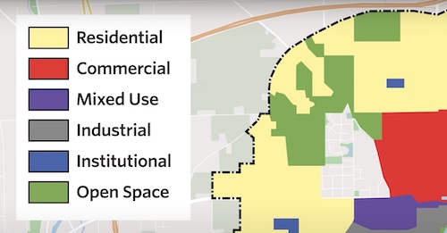
Lawmakers have concerns around “Electric Vehicle (EV) Deserts”, or areas with minimal charging stations, which tend to be divided along economic and racial lines. To remedy this, states are requiring that 40 percent of NEVI benefits go to disadvantaged, low income, rural, and tribal communities. Geospatial analysts and surveyors are now planning charging systems to ensure they are no more than 50 miles apart along freeways and highways, and no more than 1 mile from a freeway exit or highway.
Why is the involvement of the Geospatial Community critical for this build-out? Before any construction of an EV charging station can begin, location and demographics analyses, along with a land survey, should be conducted to ensure feasibility and safety.
This process is coupled with analysis of the existing utility infrastructure, such as on-site transformers, to ensure compatibility with the public utilities required to supply the chargers with energy.
There are several reasons why a sound geospatial approach is essential when constructing EV charging stations.
Site analysis and selection
Before site selection can begin, proposed locations must be carefully analyzed. Utilizing demographics and other statistical factors, a Geographic Information Systems (GIS) Analyst can determine if the site is suitable for the construction of an EV charging station. This analysis identifies any potential obstacles or challenges that may need to be addressed during design and site construction, as well as ensuring that regulatory and zoning requirements are met. Developing EV Deserts is a priority, and GIS is an excellent tool for finding a suitable oasis in that desert.
Permitting and zoning
The construction of EV charging stations requires various permits and approvals from local authorities. A land survey is necessary to determine the boundaries of the property, as well as identify any easements, rights-of-way, or other encumbrances that may impact the construction process. This information is critical for obtaining the necessary permits to comply with local land use regulations.
Design Support
The land surveyor can provide detailed measurements of the site’s topography (contours), existing improvements, and other site features to aid in the design of the charging station. This includes careful representation of all parking stripes, driving lanes, accessible parking, crosswalks, and other traffic control elements so that changes to the site comply with regulatory and jurisdictional mandates.
Construction Support
Once the site has been selected, and permits have been obtained, the construction process can begin. A land surveyor can provide detailed field locations, called staking, to ensure that the charging station is properly constructed, or “laid out” per the plans. The surveyor can also document any deviations from plans by notating or surveying the portions that need to be “field fit” due to unforeseen site conditions.
Safety and Liability
One of the most critical aspects of constructing EV charging stations is ensuring that it is safe for both the public and the environment. A land surveyor can identify any potential hazards (i.e., unstable soil, drainage issues, environmentally sensitive areas, or other potential dangers) that could impact the safety, reliability, and environmental compliance of the charging station. This information can minimize the risk of accidents or other liability issues.
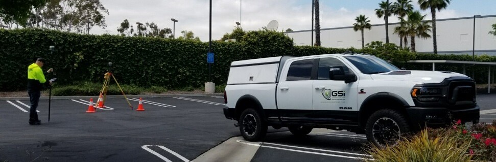
There are several types of land surveys that may be necessary for the construction of an EV charging station; they can typically be 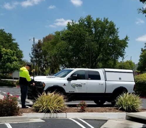 combined into a single product for a comprehensive review. The primary types of surveys that bring value to the project are as follows:
- Boundary survey - used to determine the precise boundaries or limits of the property.
- Topographic survey - provides detailed information about the land's topography (contours), drainage, vegetation, paved surfaces, and other on-site improvements.
- Utility survey - essential for determining the on-site resources, improvements, and conflicts associated with public and private utility infrastructure, helps determine capacity of the required electric system, and that no damage occurs to the existing utilities.
- Geotechnical survey - used to evaluate the soil conditions and stability of the site.
The need to understand how people travel from location to location on a daily basis has never been greater. Not only can advanced geospatial analytics help solve the problem of EV Deserts, but it also can help the planet by understanding where electric vehicles can have the biggest impact on air quality.
Land surveying is a critical component of the planning, design, and construction process for EV charging stations. Remember the saying of any good carpenter when it comes to his work: “Measure twice and cut once.” The value of great geospatial products and services for your important project is the assurance that you will only need to “cut once”.
Dennis Rose, PLS is Chief Operating Officer at GIS Surveyors, Inc. (GSi), which is a veteran-owned geospatial firm with land survey, lidar, GIS & utility locating.
GIS Surveyors, Inc. | www.gissurveyors.com
Author: Dennis Rose, PLS
Volume: 2023 July/August