


No Fear - Trusting remote sensors in wind farm prospecting


Our industry is pretty risk-averse. Some of us like to take things very slowly when it comes to embracing change in the wind farm development sector. For others, it's all about change and innovation. Bigger and more efficient wind turbines added to our landscape every day harvest about 40 percent of the renewable energy used to create electricity in the U.S. However, when it comes to using remote sensors (e.g., lidar, which stands for light detection and ranging) to measure wind for future wind farms, we've been slow to adopt. We fear the lack of data quality, or that the assessment from financial institutions might not be bankable. When it comes down to it, we fear dealing with a devil we don'tknow. As the rest of the industry continues to grow, however, being comfortable with the status quo is no longer an option.
How is remote sensing used in prospecting?
 An incredible amount of work goes into developing a wind farm before the first turbine starts to produce energy. Wind measurement, or "prospecting", is required for a minimum of one year before a development plan is approved. Developers must have accurate data from this process; it is the primary variable in their bankable wind resource assessment, which is required to attain project funding. Inaccurate wind measurement could limit the amount of revenue the wind farm produces. Based on Electric Power Research Institute (EPRI) data, a 1 percent annual production increase at a typical wind farm can increase revenue by up to $500,000 per year. By reversing this EPRI data, one could surmise a similar decrease in revenue corresponding to the decrease in production.
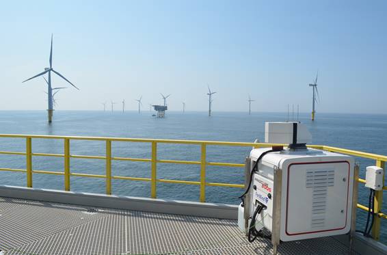
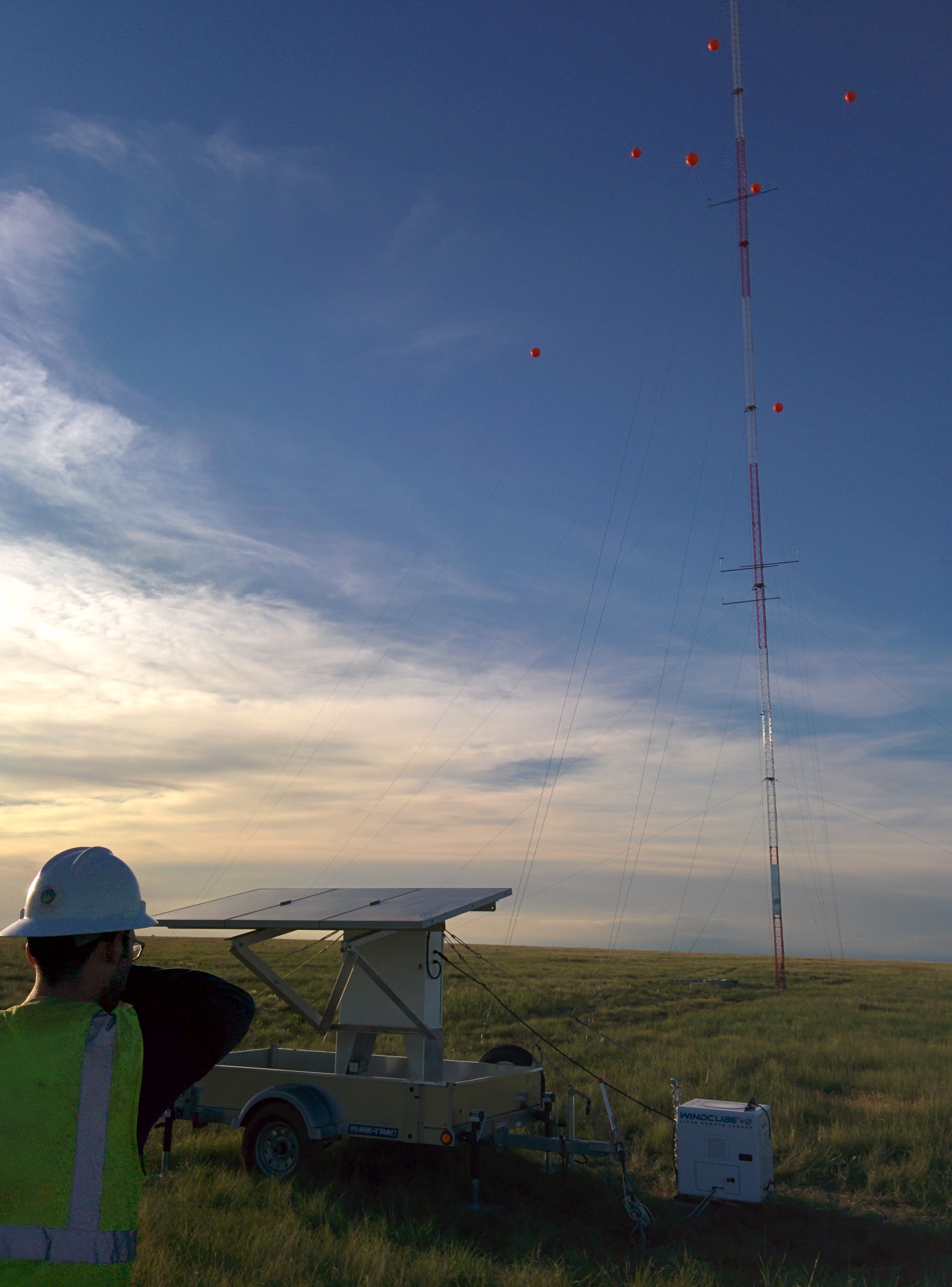
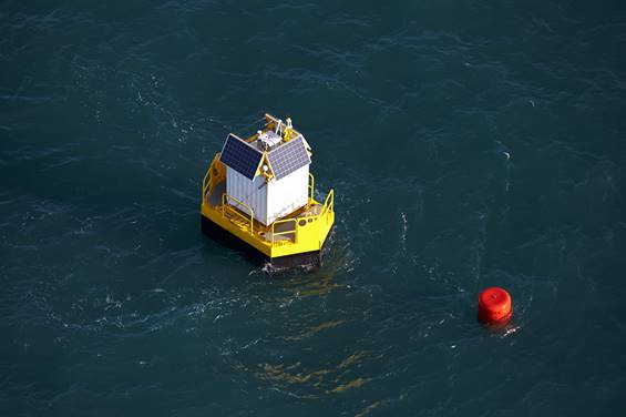
For years, meteorological evaluation towers - commonly called met towers - have been the primary technology to conduct wind measurement. However, the Federal Aviation Administration (FAA) regulates tower height. When that height exceeds 60 meters, the lighting and permitting that's required significantly increases met tower cost. As turbine rotor sweeps grow beyond 200 meters tall - larger than two football fields - met towers that don't grow with the turbine height are unable to deliver data with the enough accuracy. Remote sensing using lidar is a proven technology that allows for more accurate and expansive measurements of wind in the prospecting phase.
Fears that stifle lidar adoption
Fear #1 - Bankability. Will banks consider data measured by lidar as reliable when financing a wind farm project?
Leading independent bank engineers (IE) are familiar with remote sensing. Some have written specific guidelines for the classification of remote sensors available today. For example, some sensors are classified to be used as a stand-alone device (no other met tower is required during the measurement campaign), while others must be put next to a met tower first for calibration.
No matter which measurement technology is used, the data must be considered. For example, if your met tower was poorly sited, wasn't maintained, or experienced extreme weather conditions, some (or all) of its data can't be used. Following these same considerations for lidar data makes it equally bankable to tower data. Work closely with your IE early in the process to understand the requirements for using lidar in a bankable wind resource assessment measurement campaign.
 Fear #2 - Lidar Ownership Cost. Will it be more than the cost of a met tower?
Although lidar costs more than a standard 60-meter met tower, lidar is significantly less when compared to the cost of a hub-height met tower. And how much is your time worth? Lidar instrumentation rarely requires a permit, so you can quickly begin measurement on site. Plus, lidars have a long lifetime, and reusing lidar on various project sites quickly brings the cost benefit in favor of lidar.
Quieting fears with lidar's value
Lidar provides significant value to developers during wind prospecting.
Measuring with lidar is safer.
There are real safety concerns with met towers. They can be dangerous to install, maintain, and repair, plus heavy snow can weigh down a tower and cause it to collapse. Because small planes have been known to collide with met towers, the Federal Aviation Administration (FAA) had to provide guidance on marking and registering towers under 80 meters tall; the National Transportation Safety Board updated its safety guidelinesin 2018 for pilots regarding met towers.
Alternatively, crews installing remote sensors don't have to climb a tower for setup. Instead, the device is delivered on site, set at a specific location, and powered up. It weighs less than 100 pounds and is no more than 3 to 4 feet off the ground. As for air traffic safety, the lidar does all the work taking measurements hundreds of meters in the air, with no disruption to pilots.
 Small devices pack a massive, mobile punch.
Despite the compact nature of remote sensors in wind measurement, they keep pace with the growing size of wind turbines. Lidar technology in wind measurement sensing can reach up to 300 meters, and provides the accurate data required for a wind resource assessment measurement campaign.
Time is money.
Between permitting and installation, met towers take significant time to begin wind prospecting. Developers who use lidar sensing not only shave weeks or months off their development phase, but if they need to move the sensor for a more impactful measurement, they can do that in a matter of hours.
By openly sharing the value and successes of lidar's use in remote sensing for future wind prospecting, we can - more quickly and cost effectively - get to a place where wind energy is a sustainable and plentiful resource, keeping electricity flowing.
Greg Shambo is the North American regional director of Renewable Energy for Vaisala, Inc. He works with wind developers to help adopt innovative solutions to help increase their competitiveness and profitability. He believes that renewable energy can be both a noble cause and a thriving business.
Vaisala | www.vaisala.com
Author: Greg Shambo
Volume: 2019 September/October