Bell Geospace
Share


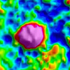 Bell Geospace acquires, processes, and interprets airborne, full-tensor, gravity gradiometry data for resource exploration. FTG data maps geologic structure associated with geothermal deposits by measuring changes in rock density.
www.bellgeo.com
As seen in: 2013 Geothermal Buyers Guide
Volume: March/April 2013